
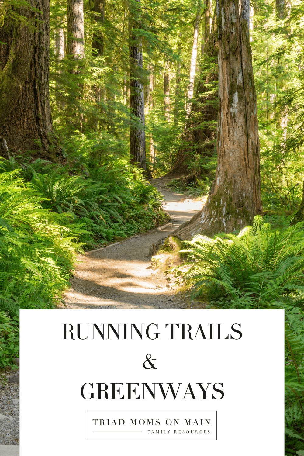
Running Trails & Greenways in the Triad

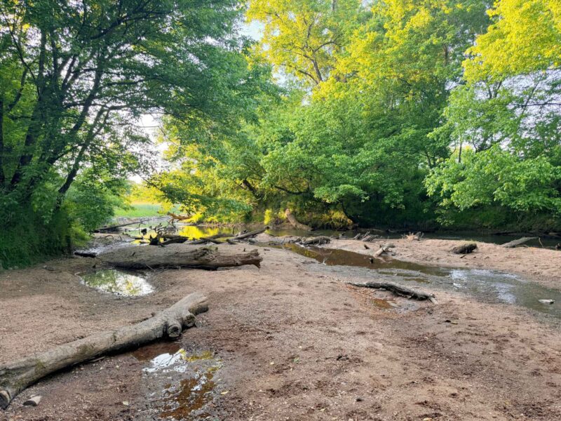
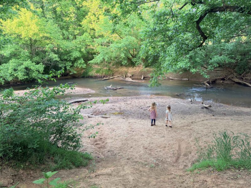
My favorite greenways/trails as a Greensboro runner are the Atlantic & Yadkin and Bicentennial Greenways. With so much history and miles exploring the city, these two greenways take you through such neat parts of the city and sections of nature/parks. The paths are shared with people and families running, walking, and biking all together. Salem Lake is another go-to in Winston-Salem. The terrain is packed gravel but the atmosphere is a good, peaceful escape with a 7-mile loop around the lake. So many miles and memories on them all over all the years!

Burlington Greenways and Running Trails
City Park Trail
Trailhead Parking: 273 E. Kitchin St. Burlington, NC 27215 (corner of Mebane St. and Kitchin St.)
Hours: Every day from sunrise to sunset
Trail Distance: 1.8 miles (with options to shorten or lengthen)
Trail Type: Loop, View the map.
Elevation Gain: 65 feet
Restroom: Located at trailhead parking near the walking track
Trail Description: A moderately trafficked loop trail, good for all skill levels. The trail is a combination of gravel, sidewalk and asphalt paths with easy to follow signage throughout. The trail meanders through Burlington City Park taking hikers by ball fields, the dog park, the amusement ride area, natural areas, as well as the aquatic center, splash park, and tennis center. The trail is primarily used for walking and running. The trail is stroller and kid-friendly. Dogs on a leash are allowed.
Davidson Park Trail
Trailhead Parking: 3715 Rural Retreat Rd. Burlington, NC 27215
Hours: Every day from sunrise to sunset
Trail Distance: 1.0 mile
Trail Type: Loop, View the map.
Elevation Gain: 42 feet
Restroom: Located behind the playground
Trail Description: A moderately trafficked loop trail good for all skill levels. The loop is a mix of paved and gravel-fines trail surface that follows the perimeter of the park. It’s great for walking and jogging. The trail is stroller and kid-friendly. Dogs on leash are allowed. On the north side of the loop there is an option to take a natural surface trail through the woods or stay to the paved trail. Davidson Park also hosts soccer and ball fields, a playground, tennis courts, picnic shelters, and restrooms.
Fairchild Trail
Trailhead Parking: 827 South Graham Hopedale Rd. Burlington, NC 27215. Other parking areas are available throughout Fairchild Park.
Hours: Every day from sunrise to sunset
Trail Distance: 1.0 mile
Trail Type: Loop, View the map.
Elevation Gain: 39 feet
Restroom: Located inside the Community Center during open hours
Trail Description: A lightly trafficked loop trail good for all skill levels. The loop is a mix of paved and gravel-fines paths. The trail is primarily used for walking and running. The trail is stroller and kid-friendly. Dogs on leash are allowed. The trail follows the perimeter of Fairchild Park taking users by ball fields, playgrounds, a picnic shelter, the BMX track, a small walking track with outdoor fitness equipment, and the Burlington Royals Baseball Stadium.
Springwood Trail
Trailhead Parking: 1450 Springwood Church Rd. Burlington, NC 27216. Trail is accessible from all parking areas, but it’s suggested to park in the lot closest to the baseball fields.
Hours: Every day from sunrise to sunset
Trail Distance: 2.2 miles (with options to shorten or lengthen)
Trail Type: Loop; View map.
Elevation Gain: 88 feet
Restroom: Located in the center of the baseball complex and at the soccer complex.
Trail Description: Springwood Trail is a 2.2 mile moderately trafficked loop trail and is good for all skill levels. This paved trail is good for walking or running. The trail is stroller and kid-friendly. Dogs on a leash are allowed. The park is mostly dedicated to athletic fields and the trail loops around the perimeter of the park offering varied views along the way. Be cautious of flying discs – as the trail often parallels the disc golf course. The trail is fairly open and offers little shade.
Walking Tracks in Burlington, NC
Walking tracks are provided around the city to provide safe opportunities to walk and exercise. Some locations have outdoor exercise equipment available around the track.
City Park | 273 E. Kitchen St. Burlington, NC 27215
Length: 0.27 mile (3.7 laps = 1 mile)
The track goes around baseball field. Additional mileage can be added by utilizing the City Park Trail.
11/30/22 UPDATE
Duke Energy will install new lights and poles at City Park ball fields 2-5. During this construction, lights will not be able to operate at the City Park walking track located at 273 E. Kitchen Street. This project’s timeline is based on weather, it will likely take place during the month of December. We are sorry for the inconvenience and look forward to new lights in the New Year!
Fairchild Park | 1411 Cloverdale St. Burlington, NC 27216
Length: 0.22 mile (4.5 laps = 1 mile)
The track goes around baseball field. Additional mileage can be added by utilizing Fairchild Trail.
Forest Hills | 227 Williamson St. Burlington, NC 27216
Length: 0.10 mile (10 laps = 1 mile)
North Park | 849 Sharpe Rd. Burlington, NC 27216
Length: 0.12 mile (8.3 laps = 1 mile)
Robinson Park | Rauhut St. and Key St. Burlington, NC 27216
Length: 0.12 mile (8.3 laps = 1 mile)
Springwood Park | 1450 Springwood Church Rd. Burlington, NC 27216
Length: 0.60 mile (1.7 laps = 1 mile)
The track goes around baseball fields. Additional mileage can be added by utilizing Springwood Trail.
Greensboro Greenways and Running Trails
https://www.greensboro-nc.gov/departments/parks-recreation/trails-greenways
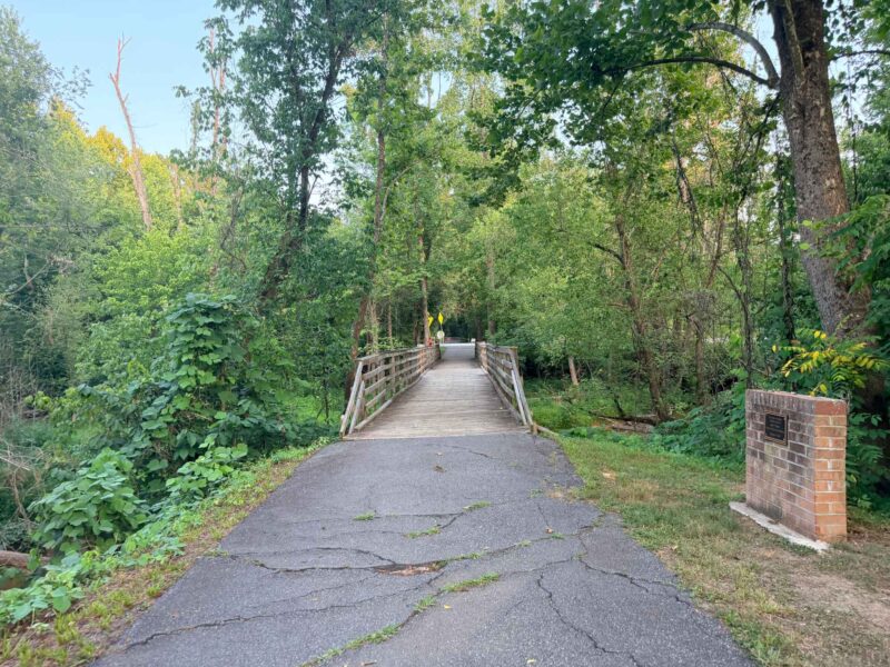
Atlantic & Yadkin Greenway* (7.5 miles)
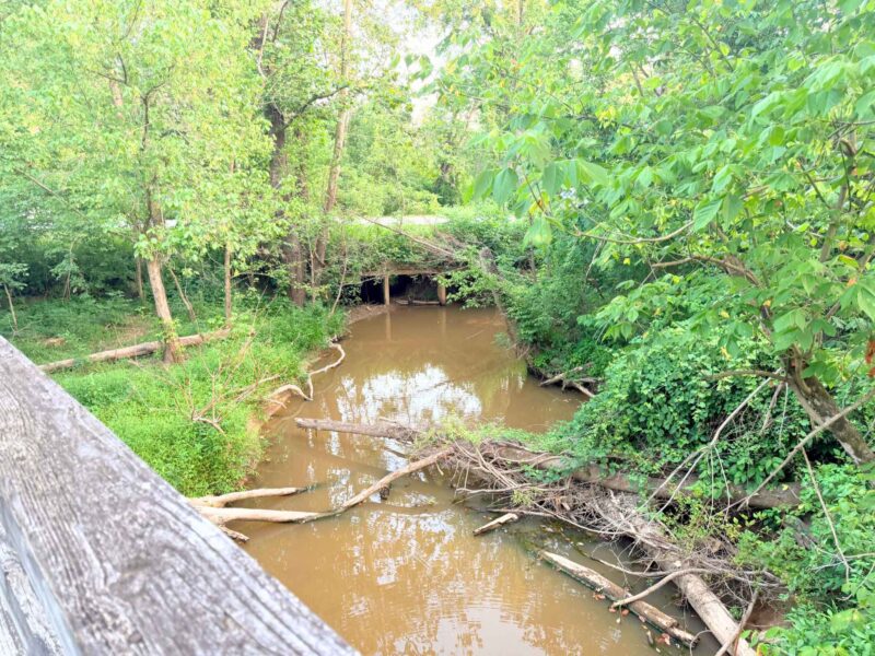
*bridge out on greenway (work on deck but not scheduled yet)
This corridor was constructed on the abandoned Atlantic-Yadkin (A&Y) railroad bed. The A&Y, Greensboro’s only current Rail Trail, provides opportunities to catch a glimpse of nature as well as reach urban destinations. The northernmost part of the greenway has a trail head parking lot, just north of Strawberry Road. Bur-Mil Park is also a good place to access the A&Y. Parking, information, and maps are available at the Frank Sharpe Wildlife Education Center. Greenway access and parking for trail users is also available at the Guilford Courthouse National Military Park parking lot on Old Battleground Road near the intersection of New Garden Road, and at Lewis Recreation Center and Country Park. A&Y users can take a detour off the greenway onto the Nat Greene Trail, Palmetto Trail, or Owl’s Roost Trail. Users can also access the Big Loop Trail and Little Loop Trail in Bur-Mil Park from the greenway. The Bicentennial Greenway intersects the A&Y at the Old Battleground and Lake Brandt road intersection as a sidewalk. From there it continues on via sidewalk along Old Battleground to the continuation of the Bicentennial Greenway as an asphalt trail at the old train trestle bridge.
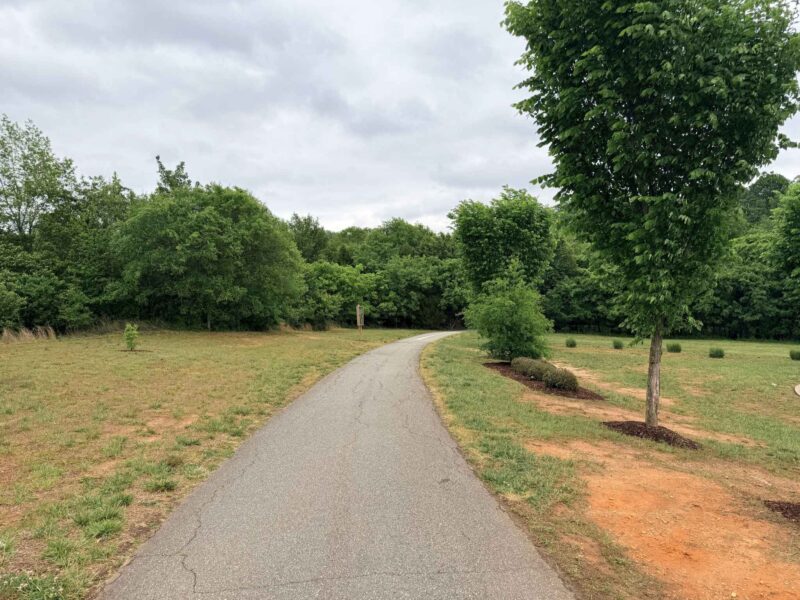
Downtown Greenway (3 miles)
When complete, this greenway will create a four-mile loop around the heart of downtown and connect not only other trails and greenways but businesses, universities and neighborhoods. The following areas are available for parking while using the greenway: On-street parking at Smith and Prescott streets for the Tradition Cornerstone, on-street parking at Lindsay and Cumberland streets for the Innovation Cornerstone, accessible trailhead parking area at 475 Spring Garden Street at Morehead Park, and trailhead parking area at Eugene and Bragg Street at Five Points.
Lake Daniel Greenway (2 miles)
Located in Lake Daniel Park, the Lake Daniel Greenway is a paved multi-use path that stretches two miles from West Friendly Avenue to Mendenhall Street, west to east, paralleling Benjamin Parkway most of the way. Exercise stations are situated along the path for a great workout. In addition, the park offers public tennis courts, a basketball court, and a children’s playground. Parking for the greenway is available at Mimosa Drive and on East Lake Drive. Latham Park and Lake Daniel Park are linked by the Hill Street Connector Trail, which incorporates sidewalks and a paved path parallel to Hill Street.
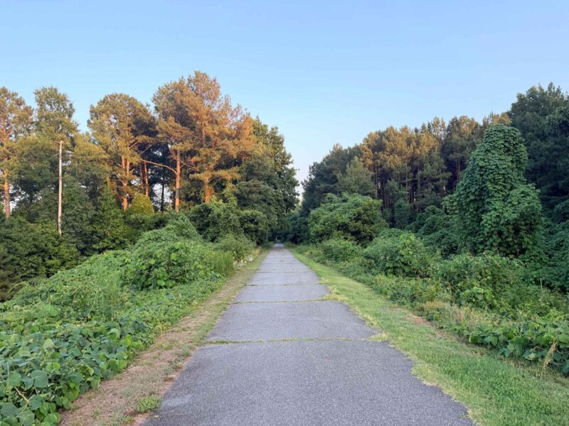
Bicentennial Greenway (14.5 miles)
When complete, the Bicentennial will provide an almost 20 mile greenway that connects the City of High Point to the City of Greensboro. The Bicentennial Greenway can be accessed just north of the Guilford Courthouse National Military Park parking lot on Old Battleground Road. The Bicentennial Greenway travels northwest along Old Battleground Road and then changes direction southwest through wooded open space. Cross Battleground Avenue and take the sidewalk along Drawbridge Parkway to Kernodle Middle School. Follow the trail signs across the road into the woods to its current terminus near Horse Pen Creek Road. The new sections can be accessed from Guilford Elementary School and the Leonard Recreation Center. From the intersection of the Bicentennial Greenway and Lake Brandt Road in Greensboro, you can connect to the A&Y Greenway leading out to Bur Mil Park. The Nat Greene Trail and Palmetto Trail are also accessible from the greenway (see map below for details). Guilford Courthouse National Military Park trails are accessible from the Bicentennial Greenway with parking available on Old Battleground Road.
Greenhaven Greenway (0.63 miles)
The Greenhaven Greenway flows through Greenhaven Park paralleling Ryan Creek. This neighborhood park allows residents to experience a number of outdoor activities in a scenic park setting. The Greenhaven Greenway is parallel to Lynhaven Drive in south Greensboro and travels south from the intersection of Mystic Drive and Lynhaven Drive. Lynhaven Drive is east of Randleman Road. Turn west onto Mystic Drive from Randleman Road and south onto Lynhaven Drive. Roadside parking is available.
Hillsdale Greenway (1 mile)
The Hillsdale Greenway traverses a linear neighborhood park in the Four Seasons Mall area on the north side of Interstate 40. This park includes playground equipment, making it a perfect setting for the entire family to enjoy. The Hillsdale Greenway parallels Meadowview Road on the north side of Interstate 40, beginning at Urban Drive. The trail then crosses Meadowview and continues along Hardie Street and west along Murrayhill Road, ending back on Meadowview Road. Roadside parking is available at most points along the trail.
Latham Park Greenway (1.2 miles)
Latham Park Greenway winds through Latham Park parallel to North Buffalo Creek. This paved multi-use path features 20 fitness stations. The fitness trail section starts at the intersection of Wendover Avenue and Cridland Road and extends northeast to the North Elm Street trailhead. In addition, there are tennis facilities, basketball courts, and Little League baseball fields available in the park. You can access the Latham Park Greenway trailhead on Hill Street, just north of Battleground Avenue and Green Hill Cemetery, with parking available. The other trailhead, north of Moses Cone Hospital on the west side of North Elm Street, is accessible to pedestrians only. Access is also possible from Cridland Road, north of Wendover Avenue, where roadside parking is available. Latham Park and Lake Daniel Park are linked by the Hill Street Connector Trail, which incorporates sidewalks and a paved path parallel to Hill Street.
Northeast Community Trail (1.2 miles)
The 1.2 miles of greenway provide the community with recreational opportunities on a beautifully-landscaped trail in northeast Greensboro. This beautiful 1.2-mile greenway is the first link in a proposed trail that will eventually connect Latham Park to Keeley Park in northeast Greensboro.
Rolling Roads Greenway (0.62 miles)
Two small playgrounds are an added bonus to this beautiful neighborhood park. Rolling Roads Park is located south of Hillsdale Park between Cheltham Boulevard and Bridgett Boulevard, just off Four Seasons Boulevard. The greenway begins at Bridgette Boulevard in the east and travels parallel to the street until it ends near Cezanne Drive. Roadside parking is available.
Shannon Hills Greenway (1.15 miles)
The Shannon Hills Greenway is a 1.15-mile greenway linking Shannon Woods Park and Shannon Hills Park. This neighborhood trail parallels Ryan Creek and is perfect for walking or jogging. The trail begins just north of Glendale Drive and runs north through Shannon Hills Park across Rehobeth Church Road into Shannon Woods Park, ending at Vandalia Road. Roadside parking is available, but please use caution.
Southeast Greenway (1.2 miles)
The Southeast Greenway, constructed in 2013, now links the Downtown Greenway to Sussman Park. The greenway connects to the Downtown Greenway near the Freeman Mill off ramp and Lee Street. The Southeast Greenway can be accessed from Sussman Park where parking is available on the street.
High Point Greenways and Running Trails
High Point Greenway (4.9 miles)
The High Point Greenway is a 4.9 mile paved trail beginning at Armstrong Park and ending at Piedmont Environmental Center. The High Point Greenway can be accessed at the following locations: Armstrong Park, Kirkman Park School, University Park (1800 Deep River Rd.), Piedmont Environmental Center (1220 Penny Rd.), Legion Lot – 1102 Penny Rd., and High Point City Lake Park Trail. https://www.highpointnc.gov/DocumentCenter/View/21695/Greenways-Map-2023
Bicentennial Greenway (6.2 miles)
The High Point section of the Bicentennial Greenway begins at the Piedmont Environmental Center and runs north to Gallimore Dairy Road. The Bicentennial Greenway can be accessed at: Piedmont Environmental Center – 1220 Penny Rd., 4125 Piedmont Pkwy., High Point, Gallimore Dairy Rd., Greensboro, Jamestown Park – 7041 East Fork Rd., Jamestown, and Gibson Park – 5207 West Wendover Ave., Jamestown. https://www.highpointnc.gov/DocumentCenter/View/21695/Greenways-Map-2023
City Lake Park (0.6 miles)
The City Lake Park Trail can be accessed at: High Point City Lake Park – 602 W. Main St., Jamestown, Legion Lot – 1102 Penny Rd., and Piedmont Environmental Center – 1220 Penny Rd.
Southwest Heritage Greenway (0.44 miles)
This .44 mile paved trail runs between Vail Avenue and Grimes Avenue with parking located at the Southside Recreation Center (401 Taylor Avenue). From Taylor Avenue to Grimes Avenue, enjoy the Botanical Woodland Teaching Garden, a helix shaped walkway that combines art with nature.
Urban “Hikes”
In partnership with the High Point Library, the city created an Urban Hikes Map with 8 trails starting from the High Point Public Library. All the hikes are accessible by sidewalk.
https://www.highpointnc.gov/DocumentCenter/View/14410/Library-Walking-Routes
Other walking paths
Burnett Park 1051 Montlieu Ave. High Point, NC 27262 1 loop = 0.3 miles
Washington Street Park 738 Washington St. High Point, NC 27260 1 loop = 0.1 miles
The Pickle Route Greensboro to High Point Fleet Feet Stores (16.4 miles)
Atlantic & Yadkin Greenway to Bicentennial Greenways (Greensboro to High Point sections) https://www.mapmyrun.com/routes/view/6112573444
Winston-Salem Greenways and Running Trails
https://www.cityofws.org/978/Greenways
Muddy Creek Greenway (2.9 miles)
Muddy Creek Greenway runs nearly three miles along Muddy Creek from Country Club Road, through Jamison Park, under Robinhood Road, and terminating at the bridge to the Summerfield Development opposite Jefferson Elementary School. Connections are as follows: Country Club Road, Five neighborhood connectors (Cedar Trail, Century Oaks, Lantern Ridge, Stonebridge, Summerfield, Brooks Landing), Jamison Park, Jefferson Elementary School, Meadowlark Middle and Elementary schools, and Robinhood Road. For more info on this one check out our post Guide to Muddy Creek Greenway & Jamison Park in Winston Salem
Bethabara Greenway (2.7 miles)
The Bethabara Greenway runs along Mill and Minorcas creeks from Reynolda Commons Shopping Center through Historic Bethabara Park, crossing Old Town Road and under Silas Creek Parkway to the Crown Oaks Apartments and Hayes Forest Drive in the Brookridge retirement community. Connections are as follows: Crown Oaks Apartments, Edgebrook Drive, Historic Bethabara Park, Midkiff Road, Old Town Drive, Old Town Road, and Reynolda Commons Shopping Center.
Bowen Branch Greenway (0.3 miles)
The Bowen Branch Greenway runs along Brushy Fork Creek from Bowen Boulevard to New Walkertown Road. Connections are as follows: Bowen Boulevard Park and Fitness Course and Ashley Middle School (via sidewalk connector), New Walkertown Road, Newell-Massey Greenway, Winston Lake Aquatics Center and Twin City Little League Complex (via sidewalk connector).
Brushy Fork Greenway (0.55 miles)
Brushy Fork Greenway runs along Brushy Fork Creek from Old Greensboro Road to Lowery Street on the other side of Business 40. Connections are as follows: Fifth Street, Lowery Street, Old Greensboro Road, Newell-Massey Greenway, and Skyland Park.
Gateway Commons Greenway (0.8 mile loop)
Gateway Commons Greenway is a loop through Gateway Commons Park between Northwest Boulevard and Glenn Avenue. Connections are as follows: Glenn Avenue, Kimberley Park, Martin Luther King Jr. Community Center, and Northwest Boulevard.
Little Creek Greenway (0.77 miles)
Little Creek Greenway runs along Little Creek from the Shoppes on Little Creek shopping center, through Little Creek Park and Recreation Center to dead-end near Atwood Road. Connections are as follows: Aztec Court, Foxcroft Drive, Little Creek Park and Recreation Center, and Shoppes on Little Creek center.
Long Branch Trail (1.6 miles)
Long Branch Trail runs from Martin Luther King Jr. Drive, through Wake Forest Innovation Quarter, under Business 40, to Salem Creek Greenway. Connections are as follows: Bailey Park, Center for Design Innovation, Fifth Street, Fourth Street, Research Parkway, Salem Creek Greenway, Seventh Street, Stadium Drive, Third Street, Wake Forest Innovation Quarter, and Martin Luther King Jr. Drive.
Newell/Massey Greenway (1.2 miles)
Newell/Massey Greenway runs along Brushy Fork from Waterworks Road to Old Greensboro Road. Connections are as follows: Bowen Branch Greenway (via sidewalk connector) Winston Lake Park, Brushy Fork Greenway, New Walkertown Road, Old Greensboro Road, Skyland Park, Twin City Little League fields, Waterworks Road, and Winston Lake Aquatics Center.
Peachtree Greenway (0.6 miles)
Peachtree Greenway runs from Salem Creek Greenway and along Peachtree Street to the Waughtown Connector/Quarry Park. Connections are as follows: Salem Creek Greenway, Peachtree Street, and Quarry Park.
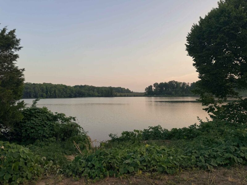
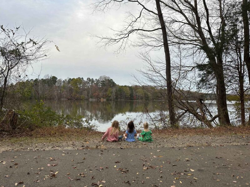
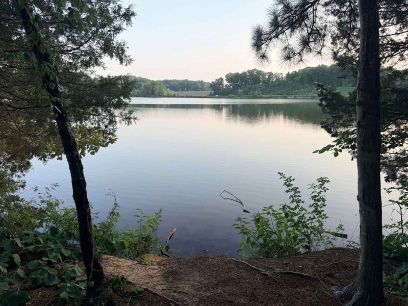
Salem Lake Trail (7 miles)
Salem Lake Trail encircles Salem Lake in Salem Lake Park. The trail is one of the most popular outings for exercise in the area, and you can see equestrians along with runners, walkers and bikers. Main and Point parking lots, playground, picnic areas and marina office. Restrooms: Salem Lake Road (marina office and near playground/picnic area) and Linville Road
815 Salem Lake Road
Winston-Salem, NC 27107
Map and Directions
Linville Road Parking Area Map
Salem Creek Greenway (5.2 miles)
Salem Creek Greenway runs along Salem Creek from Marketplace Mall, through Washington Park, under Broad Street, across Main Street and through Happy Hill and Reynolds parks to Salem Lake Park. Connections are as follows: Broad Street, Central Park, Civitan Park, Gateway YMCA, Happy Hills Park, Long Branch Trail, Main Street, Marketplace Mall, MLK Jr. Drive, Old Salem, Peachtree Greenway, Reynolds Park, Salem College, Salem Lake Park, Salem Lake Trail, Strollway, Washington Park, WSSU (Anderson Center), and Peters Creek Parkway.
Silas Creek Greenway (0.8 miles)
Silas Creek Greenway runs along Silas Creek from Shaffner Park to Robinhood Road. Connections are as follows: Burkeshore Road, Robinhood Road, Shaffner Park, Silas Creek Parkway, and Sherwood Forest Elementary School.
Strollway Greenway (1.2 miles)
The Strollway runs from Fourth Street to the Old Salem Visitors Center and Salem Avenue. The route is slated to be modified as part of the Business 40 Rebuild project. Connections are as follows: Downtown (First Street, Corpening Plaza, Second Street via sidewalk connector) Brookstown Avenue, Salem Avenue, Academy Street, Old Salem, Gateway YWCA, and Salem Creek Trail.
Waughtown Connector (1.61 miles)
The Waughtown Connector runs from Marble and Waughtown streets through Quarry Park to the Peachtree Greenway. Connections are as follows: Leight Street, Marble Street/Waughtown Street, Quarry Park, and Peachtree Greenway.
Shop Our Favorite Amazon Products by Clicking the Image Below


Other Blogs You May Enjoy: